
Date: Wednesday 1st March 2017
Company: Myself and Cuillin
Distance: 27.6km, Ascent: 1020m
Time: 6Hrs 55Mins
On Tuesday evening I spent around two hours pondering over maps in an attempt to come up with a plan for a walk the following day. According to MWIS, the best weather would be found in Deeside. As it was almost seven years since I last ascended Clachnaben, and nearly fourteen years since I last ascended Mount Battock, I decided to undertake a walk not only taking in Clachnaben and Mount Battock but also including a visit to Charr Bothy.
On Wednesday morning, I set off from home just after 06:00, arriving at the Glen Dye car park shortly after 07.30. After getting my boots on, we set off walking towards Clachnaben.
Click here to see a map of the route undertaken
The summit tor of Clachnaben is visible from miles around. "Clachnaben and Bennachie are twa landmarks frae the sea."
Clachnaben:

On my 2010 visit to Clachnaben, I set up a rope for several friends to allow them to practice abseiling in advance of ascending the In Pin. On my visit previous to that, I climbed a few routes on the tor.
Clachnaben summit tor (zoom):

During the ascent, I passed four Roe Deer.
A Roe Deer:

During the ascent I also passed a plaque advising of a Clachnaben Path Trust and several contributing organisations. I am not sure if this Trust still exists, or not, if yes they definitely need to do more work as the path is quite badly eroded in places.
Final ascent to the summit of Clachnaben:

Approaching the summit tor:

The granite tor at the summit is very impressive.
Summit tor:

Summit tor:

Despite the rocks being a little icy, we managed to scramble up the easy side to reach the summit rock.
Cuillin atop the summit tor of Clachnaben:

After ascending the summit tor, we ventured the short distance across to the trig point which according to the map is 10m lower than the tor. From the trig point, our next objective of the day, Mount Battock, looked a long way off.
Mount Battock looking a long way off:

We then commenced the circa eight kilometre walk across to Mount Battock.
Looking back to Clachnaben:

Heading for Mount Battock:

The land between Clachnaben and Mount Battock is in a shockingly bad mess. This grouse moor estate is a prime example of how to devastate landscape by bulldozing tracks here, there and everywhere. There are snap traps on logs on almost every burn. The sole objective of this estate would appear to be grouse shooting.
A wasteland of peat and hilltracks:

Looking towards Mount Battock:

During the traverse across to Mount Battock, I passed a private bothy and a private hut neither of which are marked on the map.
A private bothy:

Inside the private bothy:

Estate hut:

Beyond the bothy and hut, we commenced our ascent of Mount Battock.
Ascending Mount Battock:

Looking back to distant Clachnaben:

Final ascent of Mount Battock:

On approaching the summit of Mount Battock, I could see a large raptor soaring high above. At first I suspected it was a Buzzard or perhaps an Eagle. However on seeing the shape of its tail, I realised straight away that it was a Red Kite. This is the first time I have seen a Red Kite in the Cairngorms area.
Red Kite soaring above the summit:

On reaching the summit, I took numerous photos and then we had a seat in the summit shelter to have some food and a drink.
Large summit shelter:

Panorama at the summit of Mount Battock:

Looking back towards Clachnaben and Kerloch from the summit of Mount Battock:

Cuillin in the summit shelter:

Lochnagar (zoom):

Beinn a' Bhuird (zoom):

From the summit, we returned back the way we had came until a short distance past the private bothy where we commenced our descent to Charr Bothy. During the descent we passed six people.
Looking back to Mount Battock during descent to Charr:

Circa one kilometre before reaching Charr Bothy, we passed a dead slowworm on the track. This was the first time I have ever seen a slowworm, just a shame it was dead.
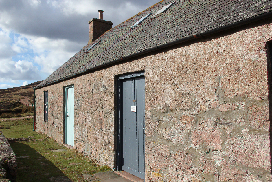
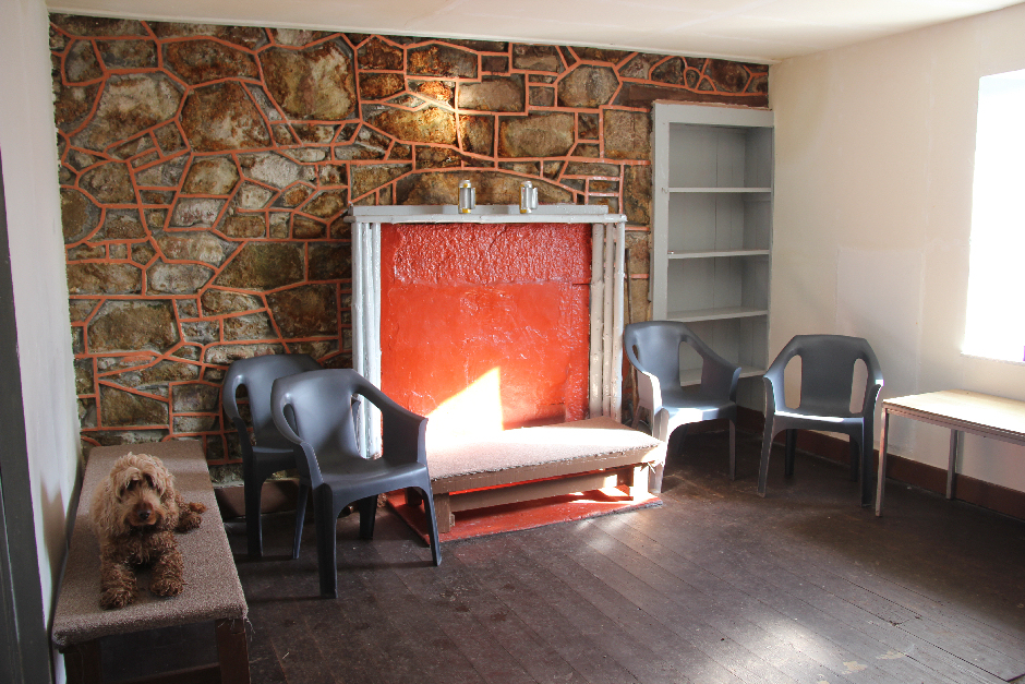
On reaching the bothy, we spent circa fifteen minutes inside. It is a wonderful bothy.
Charr Bothy:

Charr Bothy:
Inside Charr Bothy:
Just as we were about to leave, we met another walker who stays in nearby Finzean. She advised that it was good to do these hills now as they were about to be transformed into yet another windfarm. The view from Clachnaben has already been completely spoilt by another nearby windfarm. So much destruction for such an unreliable form of energy.
Before leaving the bothy, I read and took a photo of the bothy poem.
Bothy poem:

The final six kilometres back to the car were hard-going, especially for Cuillin who seemed to have hurt his paw and was limping along. Thankfully one day on he is completely fine and back to walking normally.
I enjoyed this walk for the variety of wildlife spotted including: Roe Deer, Chaffinch, Robin, Red Kite, Grouse and Mountain Hare.