
Hill: Mormond Hill (inc. Waughton Hill)
Date: Sunday 6th December 2009
Company: Myself and Beinn
Time: 2Hrs 25Mins
Dog friendly: Yes (except for one locked gate)
I set off this morning to ascend the most Easterly Marilyn in mainland Scotland - Waughton Hill.
Waughton hill is the highest point of Mormond Hill.
Mormond Hill is situated approximately 10km South of Fraserburgh. Some History (courtesy of Google):
Early Warning System:
Mormond Hill was home to Station 44 of the US North Atlantic Radio System (NARS) serving as an early warning radar system between 1961 and 1992. The NARS system was intended to warn of missile launches. The station was built in 1960, as the penultimate link in a chain of radio sites reaching from Iceland to Fylingdales in Yorkshire, which would transmit that information to the Cheyenne Mountain complex in the USA. Mormond Hill provided connectivity from the radar site at RAF Buchan to Fylingdales. NARS used tropospheric scatter to provide its communications links, however this method proved less than ideal as data rates increased over time, being replaced by more reliable satellite based systems. The USAF left Mormond Hill in 1992, and the site transferred to the MoD in 1993.
White Horse:
On the south west side of the hill is the outline of a White Horse, a war memorial formed from white quartz set into trenches cut into the turf, created by the tenants of the Strichen estate between 1820 and 1821. The landmark measures 164 feet (50 m) from nose to tail, and 146 feet (44.5 m) from head to hoof. Said to have been created by Captain Fraser (Lord Lovat of Strichen) as a tribute to Sergeant James Hutcheon of New Pitsligo. Sergeant Hutcheon gave the horseless and vulnerable captain his mount during a battle against the French near Gilze in Holland on August 26, 1794, and was then killed before he could find a loose mount for himself.
Hunter's Lodge:
Captain Fraser also built a two storey hunting lodge on the hill, dating to 1779. Now a ruin, its upper floor served as accommodation for the estate's gamekeeper. A single room on the lower floor was described as having a fireplace large enough to roast a deer, and used by the Laird and his guests after a day's hunting in the surrounding area. The door lintel still bears the words In this Hunter's Lodge Rob Gib commands, MDCCLXXIX.
White Stag:
On the east side of the hill, above the village of New Leeds, is a second outline, this time in the shape Stag. This was a wedding present, created between 1869 and 1870 by W F Cordiner of Cortes. Constructed in the same way as the Horse, and bigger than the Horse with a reported length of 240 feet.
Click here to see a map of the route undertaken
I parked in the village of Strichen and then walked up Hospital Brae passing Bransbog farm.
Start of Hospital Brae, Strichen:

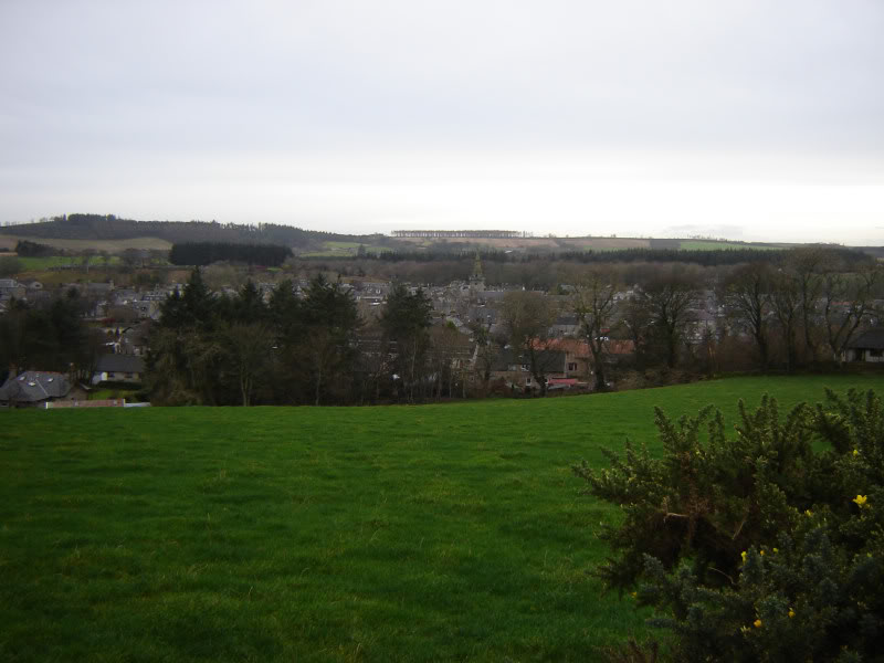
Looking back to Strichen:
Looking towards White Horse and Hunter's Lodge on skyline:

I then turned right along the road leading past Bransfarm. On reaching the end of the road I continued past a gate where there is a sign regarding footpath access to the White Horse and Hunter's Lodge.
White Horse and road leading past Bransfarm:

Geese:

Footpath sign (Note warning about bull!):

Thankfully, I didn't come across cattle or a bull on the hill although there were signs that cattle had been on the hill. There was also a further "Beware of the Bull" sign on an open gate further up the hill. A couple of small "Aberdeenshire Access" signs then directed me alongside the edge of a field and onto open hillside. Within 10-15 minutes, I reached the White Horse.
Approaching the White Horse:

Horse's head:

The hillside has lots of quartzite stones on it. I assume the stones used to make the horse were local from the hill. After passing the horse the next point of interest was Hunter's Lodge (history above).
Approaching Hunter's Lodge:

Hunter's Lodge:

Inside Hunter's Lodge:

After spending a minute or two at the lodge, I continued on to the very disinteresting summit of Waughton Hill. Waughton Hill is the summit of the Marilyn, 4m higher than the Mormond Hill trig point.
Approaching summit of Waughton Hill:

There wasn't a cairn at the highest point although there was a pile of stones not too far away.
Looking back to Hunter's Lodge from Waughton hill:

Looking towards transmitters on Mormond Hill:

Large stone en-route to Mormond Hill:

I followed the line of fenceposts until reaching a locked gate beside the track leading to the transmitters. Beinn was able to crawl under the gate, thankfully no heavy dog lifting involved.
Beinn (just past the locked gate):

Looking back to Hunter's Lodge and Waughton Hill:

At the end of the track I reached a very high locked barbed wire fence. I then followed the perimeter of the fence North-East to thankfully find an open gate.
Welcoming sign:

After a quick look about I decided to carry on to find the trig point. I was more worried about the RF Hazard than anything else. So didn't hang around long in there. No sign of CCTV. Possibly a pre Access Code sign?
A few of the transmitters:

Beinn at trig point:

From the trig point, I returned to Hunter's Lodge via a nice grassy track.
Track from Den Burn towards Hunter's Lodge:

From Hunter's Lodge, I returned to Strichen as per my inbound route.
Strichen waymarker:

Found this to be quite an enjoyable walk. Not much height gain but a few interesting features along the way.