
Date: Thursday 1st June 2017
Company: Just myself
Distance: 15.3km, Ascent: 1040m
Time: 7Hrs 10Mins
On Wednesday evening, after returning from Cape Wrath, I drove down the coast from Durness to Gruinard where I parked up for the night. The following morning, I continued the long coastal drive from Gruinard to Corran, circa one kilometre beyond Arnisdale.
Click here to see a map of the route undertaken
From Corran, I set off walking back along the road towards Arnisdale before turning off to follow the Glen Arnisdale track.
Loch Hourn from Corran:

Glen Arnisdale track:

On walking along the track, I passed a number of stags lazing about in the sun. They didn't seem bothered by my presence albeit they kept a watchful eye on me.
Stags in Glen Arnisdale:

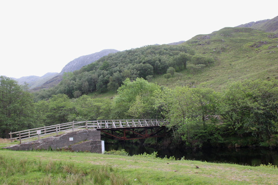
On reaching the weak bridge over the River Arnisdale, I crossed the bridge and immediately took to the hillside.
Weak bridge over the River Arnisdale:
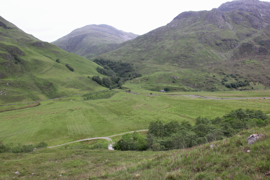
The last thing I expected to find on such a remote Fiona was any kind of track. I was therefore pleasantly surprised to find and follow a deer track leading up the hill.
Looking down towards the Achadh a' Ghlinne:
As I progressed up the hill I got increasingly good views back to Loch Hourn. I was soon to realise that Druim Fada is definitely not a dull Fiona. I would go so far as to say it is one of the top fifty hills in Scotland.
Looking back to Loch Hourn:

In advance of ascending Druim Fada, I had spent considerable time looking at the map in an attempt to work out how best to get up the steep hillside and onto the ridge. I was therefore somewhat relieved to reach the ridge and to have found the ascent much easier than anticipated. What I did however underestimate was the ridge that lay ahead!
Onto the ridge of Druim Fada:
The weather was unfortunately now getting worse as the day progressed. The views from this hill on a good weather day would be outstanding. I would therefore strongly recommend keeping this hill for a good day.
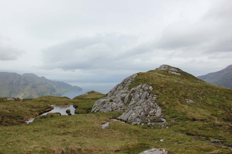
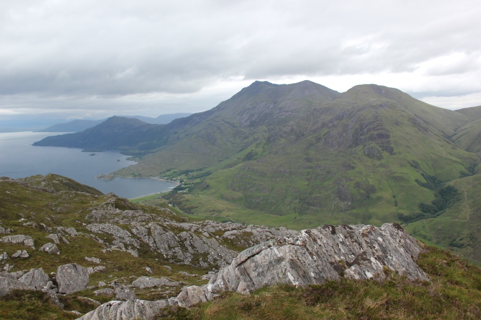
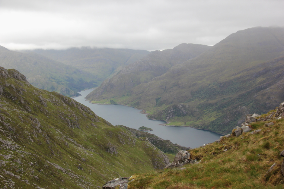
Druim Fada provides great views across to Barrisdale which is just a short distance away across Loch Hourn.
Barrisdale (zoom):

It was also nice to see Ladhar Bheinn, a classic hill that I have ascended only once previously back in 2003. A revisit is long overdue.
Ladhar Bheinn:

It was also nice to see Beinn Sgritheall and realise that I need to ascend it again in order to summit its Munro Top which I somewhat stupidly did not ascend during my previous two ascents.
Beinn Sgritheall and the Arnisdale Corbetts from Druim Fada:
Beinn Sgritheall and Loch Hourn:
Loch Hourn:

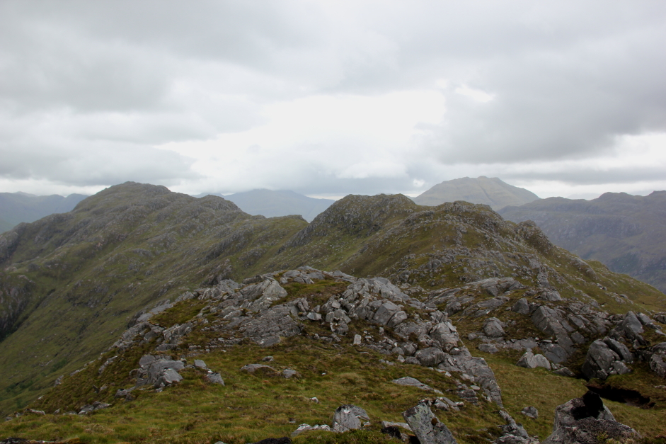
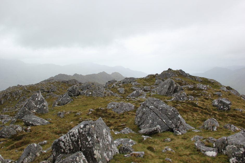
The 1:50000 OS Landranger map does not really present a true picture of the undulating nature of the ridge. To get to the summit of Druim Fada, which lies at the eastern end of the ridge, I would yet have to negotiate many ups and downs.
The undulating ridge out to the summit of Druim Fada:

It did not however take long to reach the first significant summit of the day i.e. the 614m west top.
Approaching the 614m West Top of Druim Fada:
The west top is the only top with a trig point (a broken one).
Damaged trig point at the West Top of Druim Fada:
View along the ridge from the West Top of Druim Fada:
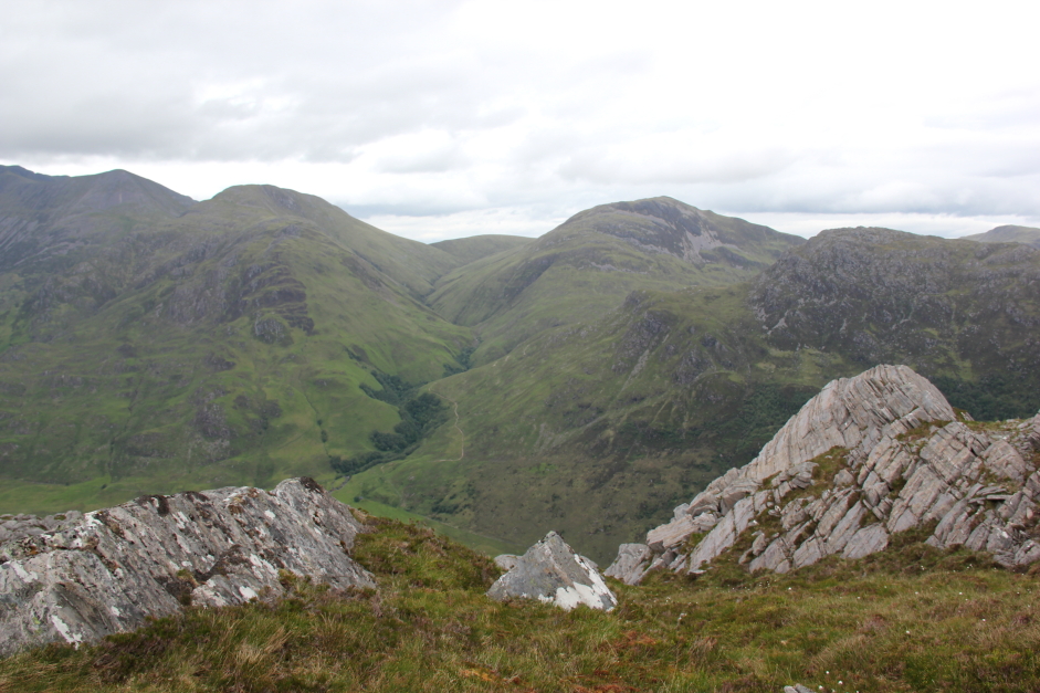
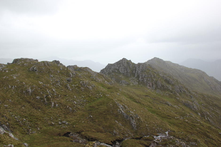
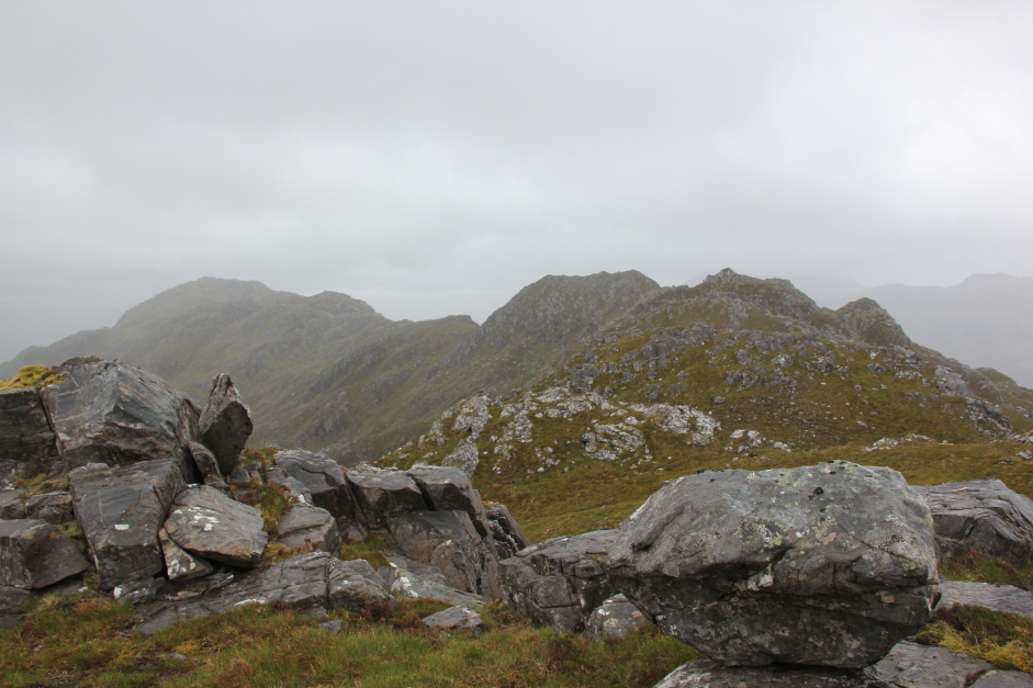
To progress along the ridge I now had to start taking numerous detours to avoid crags. It is not possible to follow the ridge directly in a straight line.
Looking back along the ridge:
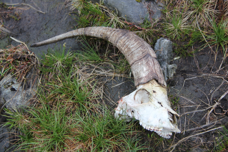
As I made my way between the 614m top and the next top I came across the remains of a mountain goat.
Mountain Goat skull:
The next photo provides an idea of the kind of rocky terrain that needs to be bypassed to progress along the ridge. Route-finding along this ridge could be quite tricky in poor visibility. In good visibility with good route finding there is no need however to put hand to rock.
Looking back to rocky side of West Top:

Heading along the ridge with many more ups and downs ahead:

I checked out a couple of potential descent routes as I made my way along the ridge thinking ahead for the way back. I could not however see an easy way leading all the way down to the glen below. I therefore decided, given the easy ascent, that I would retrace my way all the way back along the undulating ridge on my return.
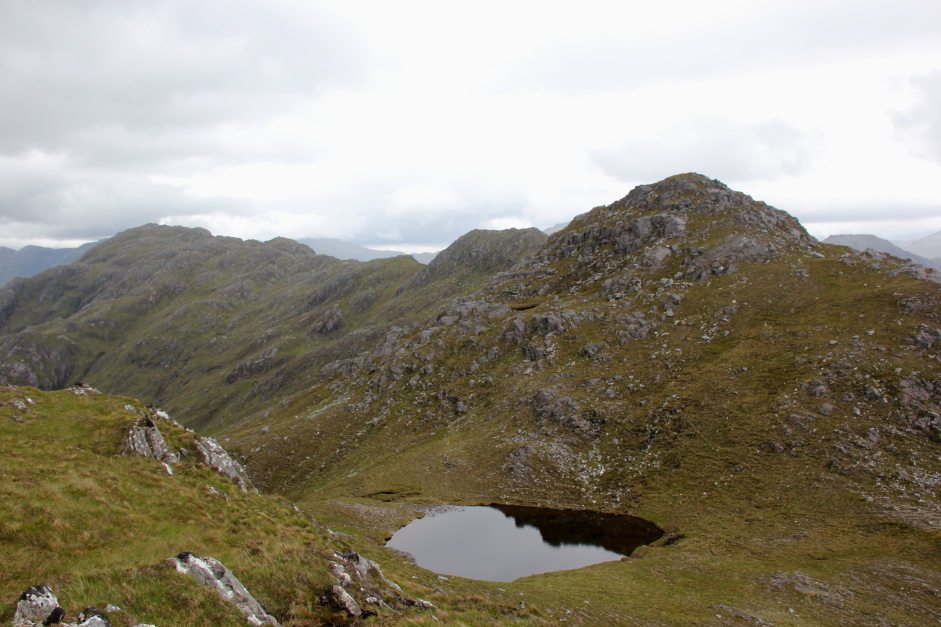
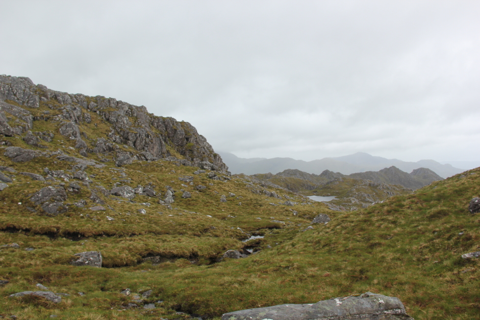
On reaching a lochan, I skirted round it to the south.
Unnamed lochan:

Looking back along the ridge towards the West Top:
Looking back along the ridge:

Beinn Sgritheall now capped in cloud:

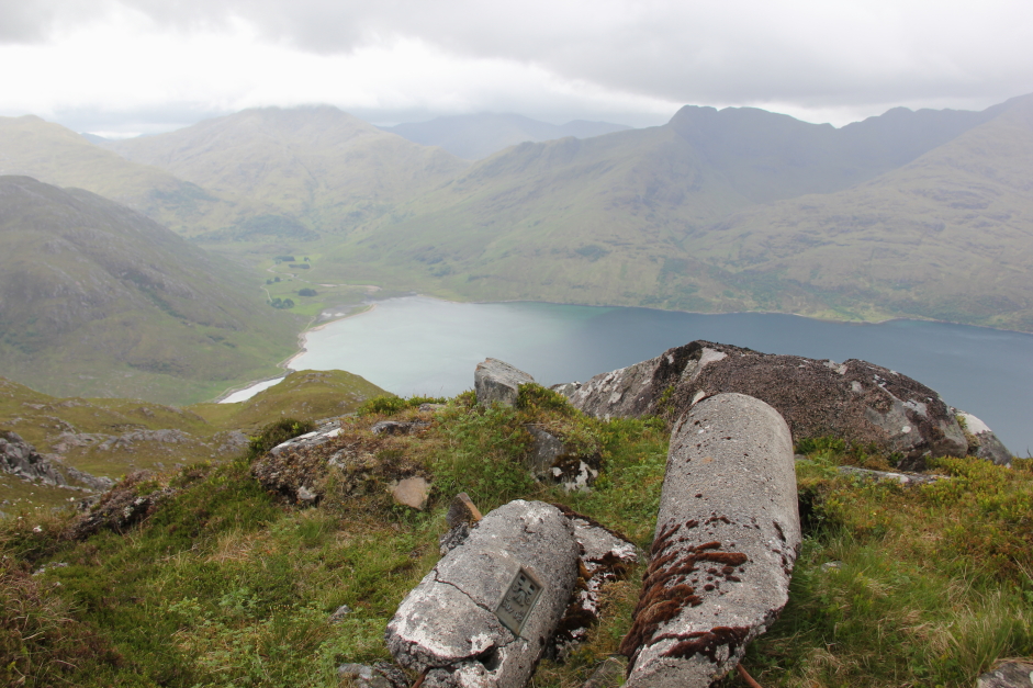
After several hours walking along the ridge, I was now at last approaching the summit.
At the summit of Druim Fada:

While it was great to reach the summit, it was disappointing that it was now raining and visibility was fairly poor.
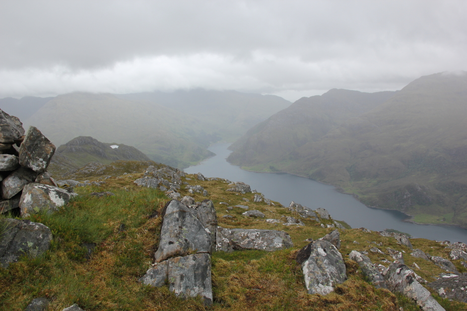
Looking down to Kinloch Hourn from the summit of Druim Fada:
Now to head back along the ridge:
From the summit, I roughly retraced my steps back along the ridge, referring to my GPS several times to check that I was again bypassing the tricky sections.
Rocky terrain:

Loch Hourn:
Barrisdale beyond Loch Hourn:

Looking back towards the summit:
During the final hour or so of walking along the ridge, and during the descent, the rain had become sufficiently heavy to warrant packing away my camera into the rucksack. There are therefore no photos until reaching the glen when the rain stopped.
The descent was nice and easy. I would strongly recommend this route in ascent or descent, or both.
After crossing the weak bridge, I took several photos of Highland cattle which were standing just beyond the bridge. They are docile beasts and generally friendly compared with other cattle breeds.
A H'lan Coo down near Corran:

On reaching Corran, I used the Community Hall facilities to have a good wash and to change my clothes for which I left a small donation for the convenience.
5 Fionas now remaining